
Vědět a znát, to mnohý by chtěl, ale učit se nechce.
Walther Von Der Vegelweide
Konference
Konference v roce 2015
Konference v roce 2014
Konference v roce 2013
Konference v roce 2012
Konference v roce 2011

Polní laboratoř
Satellite Sees Wutip in North Pacific Ocean: a New Tropical Storm
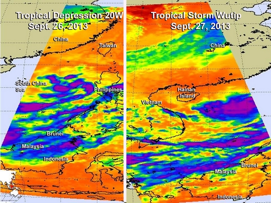
 Tropical Storm Wutip formed in the Northwestern Pacific Ocean today after being born on yesterday, Sept. 26 as Tropical Depression 20W. NASA's Aqua satellite passed over the tropical cyclone as it was intensifying and saw banding of thunderstorms circling the storm.
When NASA's Aqua satellite passed over Wutip in the South China Sea on Sept. 26 at 17:35 UTC/1:35 p.m. EDT, it was still tropical depression 20W. Infrared data from the Atmospheric Infrared Sounder or AIRS instrument that flies aboard Aqua showed bands of thunderstorms were surrounding the center of circulation, mostly to the southeast of the center. AIRS infrared satellite data showed fragmented bands of thunderstorms shifted to the northern side of the storm on Sept. 27 at 0605 UTC/2:05 a.m. EDT.
Tropical Storm Wutip had maximum sustained winds near 35 knots/40.2 mph/64.8 kph on Sept. 27 at 1500 UTC/11 a.m. EDT. It was centered near 16.9 north and 116.4 east, in the South China Sea. Tropical Storm 20W was also about 407 nautical miles/468.4 miles/753.8 km east of Da Nang, Vietnam and moving to the west at 11 knots/12.6 mph/20.3 kph.
The Joint Typhoon Warning Center or JTWC noted that warm waters in the South China Sea and low wind shear will allow Tropical Storm Wutip to intensify steadily over the next couple of days. JTWC expects Wutip to strengthen to up to 70 knots/80.5 mph/129.6 kph by Sept. 29 before crossing the Gulf of Tonkin. Wutip is expected to zigzag in a westerly direction over the next couple of days when it is expected to make landfall in central Vietnam early next week around Sept. 30.
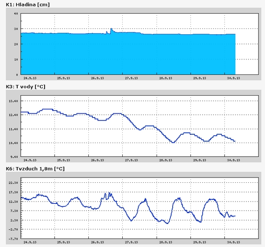
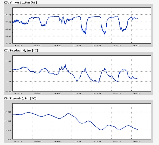
Teplota vzduchu a vody, vlhkost ,

 https://stanice.fiedler-magr.cz
Archiv
32_201331_2013
30_2013
29_2013
28_2013
27_2013
26_2013
25_2013
24_2013
23_2013
22_2013
21_2013
20_2013
19_2013
18_2013
17_2013
16_2013
15_2013
14_2013
13_2013
12_2013
11_2013
10_2013
09_2013
08_2013
07_2013
06_2013
05_2013
04_2013
03_2013
02_2013
01_2013

 | Zemědělská 1/1665 613 00 Brno Budova D | Tel.: +420 545 133 350 Fax.: +420 545 212 044 |  |
 |


