

Dobrá díla jsou plodem dobrého charakteru a protože je chvályhodnější příčina než následek, chval více dobrý charakter bez vzdělání než vzdělance bez charakteru.
Leonardo da Vinci
Konference
Konference v roce 2015
Konference v roce 2014
Konference v roce 2013
Konference v roce 2012
Konference v roce 2011


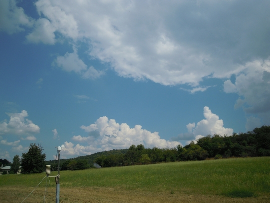
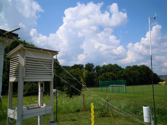
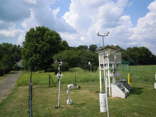
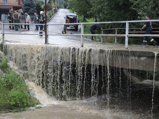
Polní laboratoř
Cloud Streets over the Bering Sea
 In early April 2013, clouds stretched in parallel rows for hundreds of kilometers over the Bering Sea. The Moderate Resolution Imaging Spectroradiometer (MODIS) on NASA’s Terra satellite captured this natural-color image of the phenomenon on April 7, 2013. The parallel clouds, known as cloud streets, originated along the edge of the sea ice, which extended southward from the snow-covered expanses of Russia and Alaska.
The location of the cloud formation was not a coincidence. When cold air blows over ice and snow and encounters moist air over open water, the meeting of the air masses can cause the formation of parallel cylinders of spinning air. Clouds form along the upward cycle in the cylinders, where air is rising, and skies remain clear along the downward cycle, where air is falling. In the north, light cloud cover partially obscured the sea ice, but its characteristic tendril shapes could still be seen through the clouds.
A NASA Infrared Baby Picture of Tropical Depression 7E
 NOAA's GOES-13 satellite captured this view of Tropical Depression 4 in the far eastern Atlantic Ocean on July 24 at 11:45 UTC (7:45 a.m. EDT).
The fourth tropical depression of the Atlantic Ocean hurricane season was born west of the Cape Verde Islands in the Eastern Atlantic Ocean on July 24. NOAA's GOES-13 satellite provides continuous views of the Atlantic Ocean basin and captured an image of the newborn storm.At 5 a.m. EDT on July 24, the National Hurricane Center announced the birth of Tropical Depression 4 or TD4. At that time TD4 had maximum sustained winds near 35 mph (55 kph). It was centered about 310 miles (500 km) west-southwest of the Cape Verde Islands, near 13.9 north and 28.1 west. TD4 was moving to the west-northwest at 20 mph (32 kph) and had a minimum central pressure of 1008 millibars. NOAA's eastern Geostationary Operational Environmental Satellite known as GOES-13 captured a visible image of Tropical Depression 4 in the far eastern Atlantic Ocean on July 24 at 11:45 UTC (7:45 a.m. EDT). The image was created by the NASA GOES Project located at NASA's Goddard Space Flight Center in Greenbelt, Md.
The image showed that the storm had become more organized overnight, and strong convection (rising air that forms thunderstorms that make up the tropical depression) had increased in coverage and become more concentrated around the center. The National Hurricane Center noted that TD4 may strengthen slightly and reach tropical storm status later in the day or on July 25 before running into drier air and cooler waters. Dry air absorbs the moisture needed to form thunderstorms, and tropical cyclones need water temperatures of at least 80F/26.6C to maintain strength.
If TD4 strengthens into a tropical storm it would be renamed Dorian.
NOAA's GOES-13 satellite captured this view of Tropical Depression 4 in the far eastern Atlantic Ocean on July 24 at 11:45 UTC (7:45 a.m. EDT).
The fourth tropical depression of the Atlantic Ocean hurricane season was born west of the Cape Verde Islands in the Eastern Atlantic Ocean on July 24. NOAA's GOES-13 satellite provides continuous views of the Atlantic Ocean basin and captured an image of the newborn storm.At 5 a.m. EDT on July 24, the National Hurricane Center announced the birth of Tropical Depression 4 or TD4. At that time TD4 had maximum sustained winds near 35 mph (55 kph). It was centered about 310 miles (500 km) west-southwest of the Cape Verde Islands, near 13.9 north and 28.1 west. TD4 was moving to the west-northwest at 20 mph (32 kph) and had a minimum central pressure of 1008 millibars. NOAA's eastern Geostationary Operational Environmental Satellite known as GOES-13 captured a visible image of Tropical Depression 4 in the far eastern Atlantic Ocean on July 24 at 11:45 UTC (7:45 a.m. EDT). The image was created by the NASA GOES Project located at NASA's Goddard Space Flight Center in Greenbelt, Md.
The image showed that the storm had become more organized overnight, and strong convection (rising air that forms thunderstorms that make up the tropical depression) had increased in coverage and become more concentrated around the center. The National Hurricane Center noted that TD4 may strengthen slightly and reach tropical storm status later in the day or on July 25 before running into drier air and cooler waters. Dry air absorbs the moisture needed to form thunderstorms, and tropical cyclones need water temperatures of at least 80F/26.6C to maintain strength.
If TD4 strengthens into a tropical storm it would be renamed Dorian.
July 30, 2013 - NASA Sees Little Rainfall in Tropical Depression Flossie
 Tropical Storm Flossie weakened as it interacted with the Hawaiian Islands and became a depression. NASA's TRMM satellite saw mostly light rain and one isolated area of heavy rainfall within the storm after it weakened. All watches and warnings were dropped for the Hawaiian Islands on July 30.
The Tropical Rainfall Measuring Mission, or TRMM, satellite flew over Flossie on July 30 at 07:17 UTC (3:17 a.m. EDT) and saw a small area of heavy rain west of the center of circulation. TRMM data showed that the rest of Flossie's rainfall was light to moderate. TRMM is managed by both NASA and the Japan Aerospace Exploration Agency.
At 5 a.m. EDT on July 30 (11 p.m. HST on July 29), the center of Tropical Depression Flossie was located near latitude 22.2 north, longitude 158.3 west. That put Flossie's center about 270 miles (435 km) northwest of Hilo and 65 miles (110 km) north-northwest of Honolulu.
The National Oceanic and Atmospheric Administration's Central Pacific Hurricane Center noted that the depression is moving toward the west-northwest near 18 mph (30 kph) and is expected to continue in that direction for the next two days. Flossie's maximum sustained winds have dropped to near 35 mph (55 kph) and the CPHC forecasts continued weakening over the next two days. Estimated minimum central pressure is 1009 millibars.
Flossie is moving into a somewhat less hostile environment. As TRMM data showed, there is no active convection (rising air forming the thunderstorms that make up the tropical cyclone) remaining near the system center Flossie. Forecasters at CPHC believe that Flossie may be "too far gone" to recover and re-strengthen. Flossie is forecast to remain a depression through 24 hours, become a remnant low in 36 hours, and dissipate by 72 hours.
The CPHC expects gusty winds will likely continue today as Flossie continues moving west-northwest.Locally heavy rainfall is expected to continue through the night-time hours on Tuesday, July 30, local time. This rainfall could cause life-threatening flash floods and mud slides.
Meanwhile, CPHC notes that dangerous high surf will continue to affect east facing shores on July 30. Large surf is expected to continue from Maui to Niihau before subsiding tonight, July 30.
The National Hurricane Center expects Tropical Depression Flossie to continue moving through the Hawaiian Islands today, July 30, reaching Maro Reef, Hawaii by Wednesday, July 31. Maro Reef is a mostly submerged coral atoll in the northwestern Hawaiian Islands, about 850 miles (1,370 km) northwest of Honolulu
Tropical Storm Flossie weakened as it interacted with the Hawaiian Islands and became a depression. NASA's TRMM satellite saw mostly light rain and one isolated area of heavy rainfall within the storm after it weakened. All watches and warnings were dropped for the Hawaiian Islands on July 30.
The Tropical Rainfall Measuring Mission, or TRMM, satellite flew over Flossie on July 30 at 07:17 UTC (3:17 a.m. EDT) and saw a small area of heavy rain west of the center of circulation. TRMM data showed that the rest of Flossie's rainfall was light to moderate. TRMM is managed by both NASA and the Japan Aerospace Exploration Agency.
At 5 a.m. EDT on July 30 (11 p.m. HST on July 29), the center of Tropical Depression Flossie was located near latitude 22.2 north, longitude 158.3 west. That put Flossie's center about 270 miles (435 km) northwest of Hilo and 65 miles (110 km) north-northwest of Honolulu.
The National Oceanic and Atmospheric Administration's Central Pacific Hurricane Center noted that the depression is moving toward the west-northwest near 18 mph (30 kph) and is expected to continue in that direction for the next two days. Flossie's maximum sustained winds have dropped to near 35 mph (55 kph) and the CPHC forecasts continued weakening over the next two days. Estimated minimum central pressure is 1009 millibars.
Flossie is moving into a somewhat less hostile environment. As TRMM data showed, there is no active convection (rising air forming the thunderstorms that make up the tropical cyclone) remaining near the system center Flossie. Forecasters at CPHC believe that Flossie may be "too far gone" to recover and re-strengthen. Flossie is forecast to remain a depression through 24 hours, become a remnant low in 36 hours, and dissipate by 72 hours.
The CPHC expects gusty winds will likely continue today as Flossie continues moving west-northwest.Locally heavy rainfall is expected to continue through the night-time hours on Tuesday, July 30, local time. This rainfall could cause life-threatening flash floods and mud slides.
Meanwhile, CPHC notes that dangerous high surf will continue to affect east facing shores on July 30. Large surf is expected to continue from Maui to Niihau before subsiding tonight, July 30.
The National Hurricane Center expects Tropical Depression Flossie to continue moving through the Hawaiian Islands today, July 30, reaching Maro Reef, Hawaii by Wednesday, July 31. Maro Reef is a mostly submerged coral atoll in the northwestern Hawaiian Islands, about 850 miles (1,370 km) northwest of Honolulu
July 29, 2013 - NASA Sees Tropical Storm Flossie Near Hawaii
 The Moderate Resolution Imaging Spectroradiometer or MODIS instrument that flies aboard NASA's Aqua satellite captured a visible image of Tropical Storm Flossie on July 28 at 23:10 UTC (7:10 p.m. EDT) as it continued moving toward Hawaii. The image showed that many of the thunderstorms have diminished in the storm.
On July 29, all of the Hawaiian Islands that have storm warnings have evacuation centers open. A Tropical Storm Warning is in effect for Hawaii County, Maui County including the islands of Maui, Molokai, Lanai and. Kahoolawe. A warning is also in effect for Oahu. In addition, a Tropical Storm Watch is in effect for Kauai and Niihau.
The main concern is the waves associated with the high tides and flooding rains. Dangerously high surf was already pounding east facing shores of the Big Island early on July 29. Surf will continue to increase through Tuesday, July 30 and may flood roadways.
Forecasters at NOAA's Central Pacific Hurricane Center expect Flossie to produce total rainfall amounts of 6 to 10 inches over the big island and Maui County with isolated maximum amounts of 15 inches possible, mostly windward. Rainfall amounts of 4 to 8 inches are possible over Oahu with isolated maximum amounts of 12 inches possible, mostly windward.
The Moderate Resolution Imaging Spectroradiometer or MODIS instrument that flies aboard NASA's Aqua satellite captured a visible image of Tropical Storm Flossie on July 28 at 23:10 UTC (7:10 p.m. EDT) as it continued moving toward Hawaii. The image showed that many of the thunderstorms have diminished in the storm.
On July 29, all of the Hawaiian Islands that have storm warnings have evacuation centers open. A Tropical Storm Warning is in effect for Hawaii County, Maui County including the islands of Maui, Molokai, Lanai and. Kahoolawe. A warning is also in effect for Oahu. In addition, a Tropical Storm Watch is in effect for Kauai and Niihau.
The main concern is the waves associated with the high tides and flooding rains. Dangerously high surf was already pounding east facing shores of the Big Island early on July 29. Surf will continue to increase through Tuesday, July 30 and may flood roadways.
Forecasters at NOAA's Central Pacific Hurricane Center expect Flossie to produce total rainfall amounts of 6 to 10 inches over the big island and Maui County with isolated maximum amounts of 15 inches possible, mostly windward. Rainfall amounts of 4 to 8 inches are possible over Oahu with isolated maximum amounts of 12 inches possible, mostly windward.
Tropical Storm Flossie is expected to bring a lot of moisture to the leeward side of the Hawaiian Islands where the Kona coffee crops are located. That moisture will then be pushed up the mountainous terrain (orographic lift), which will go over the mountainous areas and rain on the windward side. Flossie will be moving in the big island during the morning (local time) today, July 29. Satellite data shows that the center of circulation is south of the strongest thunderstorms with the coldest cloud tops. Cloud top temperatures are seen on infrared imagery from the Atmospheric Infrared Sounder or AIRS instrument that also flies aboard NASA's Aqua satellite. At 8 a.m. EDT /2 a.m. HST the Central Pacific Hurricane Center or CPHC in Honolulu, Hawaii noted that the center of Tropical Storm Flossie was located near latitude 19.6 north and longitude 152.5 west, just 165 miles (320 km) east of Hilo, Hawaii. Flossie is moving toward the west near 16 mph (28 kph) and is expected to continue for next 12 hours with a slight turn to the west northwest after that. Flossie's maximum sustained winds were near 50 mph (85 kph) and some weakening is forecast during the next 48 hours. According to CPHC, tropical storm force winds extend outward up to 100 miles (160 km) from the center. Tropical storm conditions are expected over the big Island and Maui County today and Oahu tonight. Tropical storm conditions are possible on Kauai and Niihau tonight. Dry air aloft and northerly wind shear are expected to weaken Flossie further in the next day or two as it moves through the Hawaiian Islands.
On July 31, NASA's TRMM satellite saw Tropical Storm Gil intensifying and the storm became a hurricane. NASA's Aqua satellite and NOAA's GOES-15 satellite captured views of Gil on Aug. 1 as it was being chased by another developing tropical system. The Atmospheric Infrared Sounder or AIRS instrument aboard NASA's Aqua satellite captured an infrared image of Hurricane Gil on August 1 at 10:11 UTC or 6:11 a.m. EDT. Strongest storms and heaviest rains appear around the center where cloud top temperatures exceed -63F/-52. Microwave imagery on Aug. 1 from NASA's Aqua satellite and other satellites indicated that the cloud pattern of Gil was not as organized as it appeared overnight and on July 31. Microwave imagery on Aug. 1 did not even see the ragged eye that was visible the previous day. At 8 a.m. PDT/11 a.m. EDT on Aug. 1, Hurricane Gil's maximum sustained winds were near 80 mph (130 kph). The center of Hurricane Gil was located near latitude 14.5 north and longitude 124.2 west. Gil is far from land areas and is about 1,100 miles (1,770 km west-southwest of the southern tip of Baja California, Mexico. Gil is moving toward the west near 13 mph/20 kph. That motion is expected to continue for the next 48 hours. The estimated minimum central pressure is 990 millibars.The National Hurricane Center noted that Gil is moving into more stable air and cooler waters, which will make any intensification over the next day brief, before the storm starts to weaken. Traveling behind Gil, or to Gil's east, is System 90E. Imagery from NOAA's GOES-15 on Aug. 1 at 1500 UTC (11 a.m. EDT) clearly showed Hurricane Gil and System 90E trailing behind. The image was created at NASA's GOES Project at the NASA Goddard Space Flight Center in Greenbelt, Md. This low pressure area is about 775 miles south-southwest of the southern tip of Baja California and 325 miles away from Hurricane Gil. System 90E is moving west at 10 mph and has a 50 percent chance of becoming a tropical depression in the next two days, according to the National Hurricane Center.
Unsettled Weather Across Central Australia
 In late July 2013, a low pressure system off Australia’s southeast coast and moist onshore winds combined to create unsettled weather across central Australia – and a striking image of a broad cloud band across the stark winter landscape. The Moderate Resolution Imaging Spectroradiometer (MODIS) aboard NASA’s Terra satellite captured this true-color image on July 22 at 01:05 UTC (10:35 a.m. Australian Central Standard Time).
To the west of the low pressure trough the skies are clear and dry. To the east, the broad band of bright white clouds obscures the landscape. The system brought wind, precipitation and cooler temperatures to the region. Image Credit: NASA/Jeff Schmaltz, MODIS Land Rapid Response Team, NASA GSFC
In late July 2013, a low pressure system off Australia’s southeast coast and moist onshore winds combined to create unsettled weather across central Australia – and a striking image of a broad cloud band across the stark winter landscape. The Moderate Resolution Imaging Spectroradiometer (MODIS) aboard NASA’s Terra satellite captured this true-color image on July 22 at 01:05 UTC (10:35 a.m. Australian Central Standard Time).
To the west of the low pressure trough the skies are clear and dry. To the east, the broad band of bright white clouds obscures the landscape. The system brought wind, precipitation and cooler temperatures to the region. Image Credit: NASA/Jeff Schmaltz, MODIS Land Rapid Response Team, NASA GSFC
Teplota vzduchu a vody, vlhkost ,
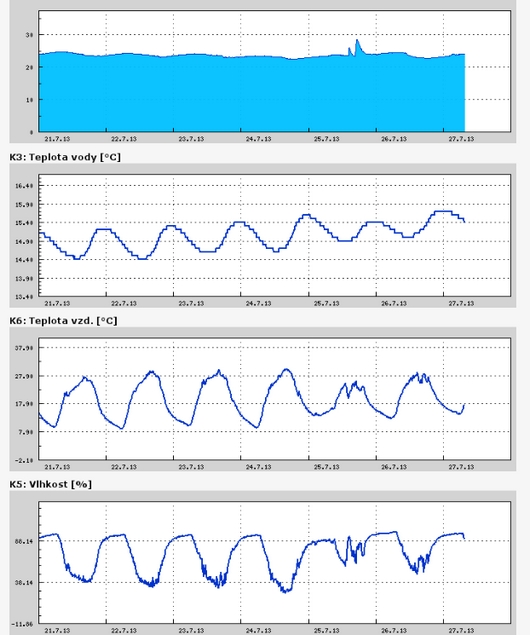 https://stanice.fiedler-magr.cz
Archiv
26_201325_2013
24_2013
23_2013
22_2013
21_2013
20_2013
19_2013
18_2013
17_2013
16_2013
15_2013
14_2013
13_2013
12_2013
11_2013
10_2013
09_2013
08_2013
07_2013
06_2013
05_2013
04_2013
03_2013
02_2013
01_2013

 | Zemědělská 1/1665 613 00 Brno Budova D | Tel.: +420 545 133 350 Fax.: +420 545 212 044 |  |
 |