

Není hanbou nic nevědět, ale je hanbou, nechtít se ničemu učit.
Konference
Konference v roce 2015
Konference v roce 2014
Konference v roce 2013
Konference v roce 2012
Konference v roce 2011


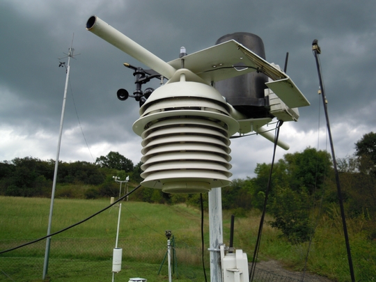
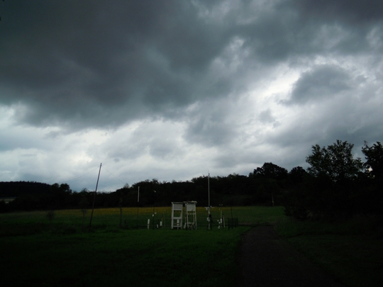
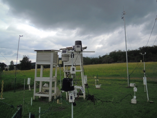
Polní laboratoř
NASA Sees Tropical Storm Trami U-Turning
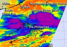 NASA's Aqua satellite passed over Tropical Storm Trami on Aug. 18 it looked at the storm in an infrared light and saw coldest cloud top temperatures and strong thunderstorms (purple) around the center and in a band of thunderstorms south of the center. Tropical Storm Trami appears to be a very large storm in infrared data from NASA's Aqua satellite. In a NASA image, Trami appears to be about two-thirds the size of the Philippines. Satellite data also indicates that the massive storm is now making a U-turn in the Northwestern Pacific Ocean, from a southeastern path to a northwestern path.When NASA's Aqua satellite passed over Tropical Storm Trami on Aug. 18, the AIRS instrument aboard captured an infrared image that showed a large area of thunderstorm activity within the storm. The Aqua satellite passed over Trami at 17:29 UTC/1:29 p.m. EDT on Aug. 18. Aqua's Atmospheric Infrared Sounder instrument looked at the storm in an infrared light. The infrared data showed the coldest cloud top temperatures circled the center of the storm and were in a strong band of thunderstorms wrapping into the center from the southwest. Trami continued to show the same organization on Aug. 19.Multispectral satellite imagery on Aug. 19 revealed that the low-level center has been consolidating. Whenever a storm consolidates, it typically means that it can spin faster and winds increase. Data from Defense Meteorological Satellite Program polar orbiting satellites showed a near-complete eye-wall, and confirmed the strong band of thunderstorms over Trami's southern semi-circle.At 1500 UTC/11 a.m. EDT, Tropical Storm Trami was located about 391 nautical miles south of Kadena Air Base near 20.3 north and 128.4 west. Trami was moving slowly to the northeast at 4 knots/4.6 mph/7.4 kph. Maximum sustained winds were near 50 knots/57.5 mph/92.6 kph.
NASA Sees Tropical Storm Unala Develop and Weaken Quickly
Cloud top temperatures in thunderstorms circling Tropical Storm Unala's (right) center on Aug. 19 at 0105 UTC were colder than -63F/-52C, indicating strong storms with heavy rain potential. Typhoon Pewa's (left) cloud tops were colder. NASA's Aqua satellite has been busy capturing temperature data from developing tropical cyclones around the world. Aqua captured an image of Tropical Storm Unala in the central Pacific Ocean where it formed early today, Aug. 19. Over several hours, Unala moved into the northwestern Pacific where it quickly weakened to a depression. NASA's Aqua satellite caught Unala in the same image as Typhoon Storm Pewa, which is responsible for Unala's quick weakening. The two tropical cyclones are just 184 nautical miles apart and are expected to be just 60 miles from each other later today (Aug. 19).The Atmospheric Infrared Sounder or AIRS instrument captures infrared data and scientists are able to measure cloud top temperatures of storms, and surrounding sea surface temperatures: two factors that are important in understanding what's happening or will happen with tropical cyclones. Tropical cyclones need sea surface temperatures of at least 26.6C/80F to survive and thrive, and temperatures in the vicinity of Tropical Depression Unala are at least that warm. Cloud top temperatures in the thunderstorms that make up tropical cyclones tell scientists how high the cloud tops are in the troposphere, and the higher the storm, the colder it is, and the stronger it is.Cloud top temperatures in thunderstorms circling Unala's center early on Aug. 19 were around -63F/-52C, indicating there were some strong storms with heavy rain potential, but those cloud tops warmed later in the day, indicating weakening. Storms in nearby Pewa showed colder temperatures, and Pewa has since become a typhoon.At 1500 UTC/11 a.m. EDT on Aug. 19, Tropical Depression Unala had maximum sustained winds near 30 knots/34.5 mph/55.5 kph, after peaking earlier in the day at 40 mph/65 kph. The center of Unala was located near latitude 17.3 north, longitude 178.1 west, about 705 nautical miles east of Wake Island. The estimated minimum central pressure is 1008 millibars. Unala was moving toward the west near 20 mph/32 kph, and this general motion is expected to continue for the next day.Forecasters at the Central Pacific Hurricane Center noted that the interaction between Unala and Typhoon Pewa is expected to cause Unala to weaken more and dissipate within 24 hours.
NASA Catches Short-lived Northwestern Pacific Ocean Tropical Depression 13W
 Before TD13W dissipated, NASA's Aqua satellite captured an image of the short-lived storm on Aug. 18 that showed the depression still had a circulation and thunderstorms around its center. The thirteenth Tropical Depression of the Northwestern Pacific Ocean season didn't last long. In fact, Tropical Depression 13W lived for less than a day as a depression before fizzled.TD13W was "born" at 1500 UTC/11 a.m. EDT on Aug. 17 with maximum sustained winds near 25 knots. Later that day at 2100 UTC/5 p.m. EDT, the Joint Typhoon Warning Center issued its final bulletin on the depression. At that time it was located near 28.0 north latitude and 126.0 east longitude, about 109 nautical miles northwest of Kadena Air Base, Japan.
Before TD13W dissipated, the MODIS instrument that flies aboard NASA's Aqua satellite captured an image of the short-lived storm on Aug. 18 that showed the depression still had a circulation and thunderstorms around its center.On Sunday, Aug. 18, while Tropical Depression 12W had strengthened into Tropical Storm Trami, nearby Tropical Depression 13W had already weakened and by Aug. 19 became a remnant low pressure area. Trami was located to Tropical Depression 13W's southeast. Because TD13W was to Trami, the tropical storm basically took the life out of TD13W.
Before TD13W dissipated, NASA's Aqua satellite captured an image of the short-lived storm on Aug. 18 that showed the depression still had a circulation and thunderstorms around its center. The thirteenth Tropical Depression of the Northwestern Pacific Ocean season didn't last long. In fact, Tropical Depression 13W lived for less than a day as a depression before fizzled.TD13W was "born" at 1500 UTC/11 a.m. EDT on Aug. 17 with maximum sustained winds near 25 knots. Later that day at 2100 UTC/5 p.m. EDT, the Joint Typhoon Warning Center issued its final bulletin on the depression. At that time it was located near 28.0 north latitude and 126.0 east longitude, about 109 nautical miles northwest of Kadena Air Base, Japan.
Before TD13W dissipated, the MODIS instrument that flies aboard NASA's Aqua satellite captured an image of the short-lived storm on Aug. 18 that showed the depression still had a circulation and thunderstorms around its center.On Sunday, Aug. 18, while Tropical Depression 12W had strengthened into Tropical Storm Trami, nearby Tropical Depression 13W had already weakened and by Aug. 19 became a remnant low pressure area. Trami was located to Tropical Depression 13W's southeast. Because TD13W was to Trami, the tropical storm basically took the life out of TD13W.
Teplota vzduchu a vody, vlhkost ,
 https://stanice.fiedler-magr.cz
Archiv
28_201327_2013
26_2013
25_2013
24_2013
23_2013
22_2013
21_2013
20_2013
19_2013
18_2013
17_2013
16_2013
15_2013
14_2013
13_2013
12_2013
11_2013
10_2013
09_2013
08_2013
07_2013
06_2013
05_2013
04_2013
03_2013
02_2013
01_2013

 | Zemědělská 1/1665 613 00 Brno Budova D | Tel.: +420 545 133 350 Fax.: +420 545 212 044 |  |
 |